|
From Points to Curves
Goals
The aim is to familiarize yourself with the basic features of points and curves and learn to create and modify curves.
Content in a nutshell
- How to draw a curve by control points and draw a curve by interpolation points?
- How to modify curves (with fillet, extend, trim, offset)?
- What are points and point clouds?
Curve by control point & curve by interpolation point
Curves in many surface modelers (like Rhino) are NUBS curves.
Curve by control points: The connection lines of adjacent control points are tangent to the curve, so the control point is not on the curve.
Curve by interpolation points: The curve connects the points smoothly. The position of the curve is settled, but the curvature is flexible.
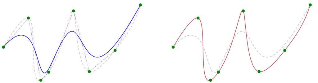
Draw curves through the same points by different methods: curve by control points (blue); curves by interpolation points (red).
Modify curves
Fillet: connect straight line or curve by an arc if the circle of the certain radius could be tangent to the two lines (or curves).
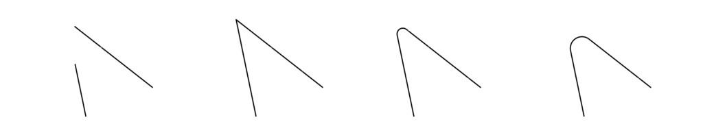
Fillet two lines with different radius.
Trim: Cut off the end of the curve outside another curve or surface.
Extend: Extend the curve to another curve or surface.
Offset: Copy the curve that all the locations on the copied curve are a specified distance from the original curve.
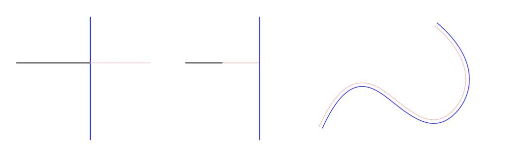
Left: trim; vertical line can be used to trim the horizontal line.
Middle: extend; horizontal black line can be extended to the vertical line.
Right: offset; the distance between the new pink curve and the original blue curve is constant (distance is measured perpendicular to the curve).
Point and point cloud
A point cloud is a set of points. It could represent 3D shapes and objects (Wikipedia: point cloud). Point cloud produced by 3D scanners projects the object in reality (such as terrain, historical buildings, and manufacturing components) to a 3D model.
Examples
What you can create with a point cloud?
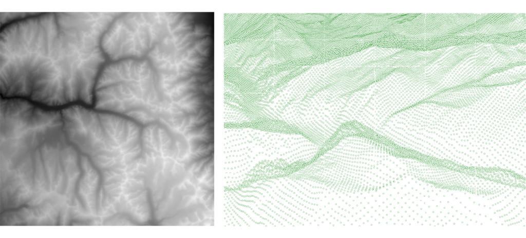
Left: a greyscale heightmap picture of a terrain;
Original photo: Julien Lecaché
Right: Point cloud model of the terrain (closer look).
All pictures in this page: Fanyi Jin (except heightmap)
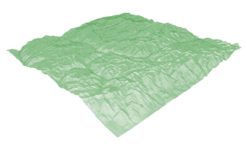
Point cloud model of the terrain (overall look)

3D scan of Lau Pa Sat hawker center in Singapore in a format of a colored point cloud. Done in collaboration between SUTD and Aalto Design of Structures group.
Chapters